Imagine standing on a small fishing boat in a quiet, remote Alaskan bay. The sun is setting. It's July 9, 1958. Suddenly, the world starts to shake so violently you can't even stand up. You look toward the head of the bay and see something that shouldn't be physically possible: a wall of water so tall it’s literally swallowing mountains.
This isn't a script for a big-budget disaster movie. This actually happened.
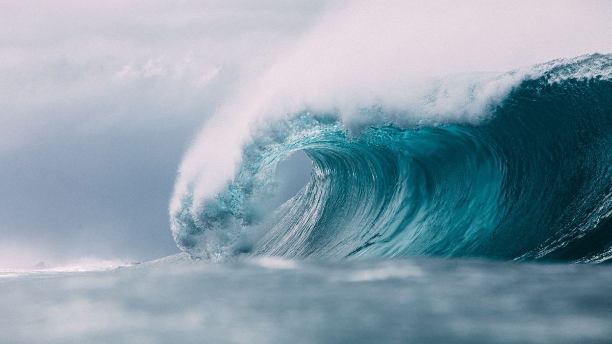
Most people think the biggest tsunamis are the ones that devastated the Indian Ocean in 2004 or Japan in 2011. While those were horrific and far more deadly, they don't even come close to the sheer vertical height of what happened in Lituya Bay. We’re talking about the largest tsunami in the world ever recorded—a "megatsunami" that reached a staggering 1,720 feet.
To put that in perspective, the Empire State Building is only 1,454 feet tall. If that wave had hit New York City, the tip of the spire would have been underwater.
The Night the Mountain Fell
Lituya Bay is a T-shaped fjord on the coast of southeast Alaska. It’s beautiful, isolated, and, as it turns out, a bit of a geological trap. That night in 1958, a massive 7.8 magnitude earthquake struck along the Fairweather Fault. The shaking was so intense it caused a colossal chunk of rock—about 40 million cubic yards—to break loose from a cliff and plunge 3,000 feet straight into Gilbert Inlet at the head of the bay.
Basically, it was like dropping a massive brick into a bathtub, but the brick was the size of a mountain.
The displacement was instantaneous. The water didn't just ripple; it exploded. The initial splash slammed into the opposite headland with such force that it stripped every single tree, every bit of soil, and all vegetation right off the bedrock up to an elevation of 1,720 feet (524 meters). Scientists later called this "run-up."
Survival Against All Odds: The Ulrich Story
Honestly, the most insane part of this story isn't just the height of the water—it’s that people actually lived through it. There were three small fishing boats anchored in the bay that night.
Howard Ulrich and his seven-year-old son, Howard Jr., were on the Edrie. Ulrich woke up to the boat rocking like crazy. He looked toward the head of the bay and saw what he described as a mountain of water. He barely had time to get a life jacket on his son. He tried to pull the anchor, but the chain wouldn't budge, so he let it all out.
The wave picked them up and carried them over the trees.
You've gotta realize, they weren't just on a big wave; they were literally looking down at the tops of forests as they were swept along. Miraculously, the Edrie stayed upright. The wave eventually surged out into the Gulf of Alaska, and the Ulrichs survived with barely a scratch.
Not everyone was so lucky. The Sunmore, with Bill and Vivian Wagner on board, was caught by the wave and never seen again. The third boat, the Badger, was carried over the spit at the mouth of the bay—riding the wave "like a surfboard" according to the captain—before it finally sank. The couple on board managed to jump into a skiff and were eventually rescued.
Why Lituya Bay Keeps Breaking Records
You might wonder why this place specifically gets such monster waves. It’s not a fluke. Geologists like Don Miller, who spent years studying the area, found evidence of at least four other massive waves dating back to the mid-1800s.
The bay is shaped perfectly for disaster.
- Narrow Entrance: The mouth of the bay is very narrow, which bottles up the water.
- Deep Fjord: The deep water allows for massive displacement.
- Steep Walls: The surrounding mountains are basically vertical, making landslides much more likely during earthquakes.
Even today, if you visit Lituya Bay (which is part of Glacier Bay National Park), you can still see the "trimline." It’s a very distinct line on the mountains where the old-growth forest ends and the younger, lighter-green trees begin. That line marks exactly how high the water climbed seventy years ago. It's a permanent scar on the landscape.
Misconceptions About Tsunami Height
People often get confused about how we measure tsunamis. When you hear about the 2004 Indian Ocean tsunami having "30-foot waves," that’s the height of the wave as it travels. The largest tsunami in the world measurement of 1,720 feet refers to the run-up height—how high the water actually climbed up the dry land.
If the 1958 wave had happened in the open ocean, it wouldn't have been 1,700 feet tall. It was the "splash" factor and the confined space of the bay that forced the water to those impossible heights.
What This Means for Us Today
Scientists use the data from Lituya Bay to model what could happen in other places, like the Canary Islands or even fjords in Norway. These "landslide-generated" tsunamis are different from the ones caused by seafloor shifts. They are faster, more localized, and significantly taller.
While the chances of you being caught in a megatsunami are incredibly low, the 1958 event changed how we understand coastal risks. It proved that water can behave in ways we previously thought were impossible.
Practical Insights for Travelers and Residents:
- Geography Matters: If you are in a deep, narrow bay or fjord during an earthquake, the risk of a "splash" wave is often higher than a traditional tsunami.
- The "Trimline" Tell: If you're exploring coastal Alaska or similar terrain, look at the trees. A sharp change in forest age along a shoreline is a natural warning sign of historical wave activity.
- Immediate Action: In 1958, the survivors had less than three minutes from the start of the earthquake to the arrival of the wave. If you feel "long and strong" shaking near the coast, move to high ground immediately. Don't wait for a siren.
The 1958 Lituya Bay event remains a humbling reminder of nature's power. It’s a story of a mountain falling into the sea and a few lucky people who lived to tell the world that yes, a wave can actually be taller than a skyscraper.
To see the lasting impact for yourself, you can view the "trimline" via high-resolution satellite imagery on Google Earth—look for the lighter green vegetation hugging the shore of Lituya Bay, Alaska.